
We’re creating a new satellite imagery map to help protect Brazil’s forests
Google partnered with the Brazilian government on a satellite imagery map to help protect the country’s forests

Google partnered with the Brazilian government on a satellite imagery map to help protect the country’s forests. This project aims to provide tools and resources to monitor and prevent deforestation in Brazil.
Keep reading online — scan the code
https://go.tricuatro.com/mGjGJ
© tricuatro.com
Article topics
Related articles

MIT Chip Converts Invisible Infrared Light into Crucial Data
MIT researchers developed an innovative chip detecting methane and propane using mid-infrared light, with potential for millions of pixels and optical computing.
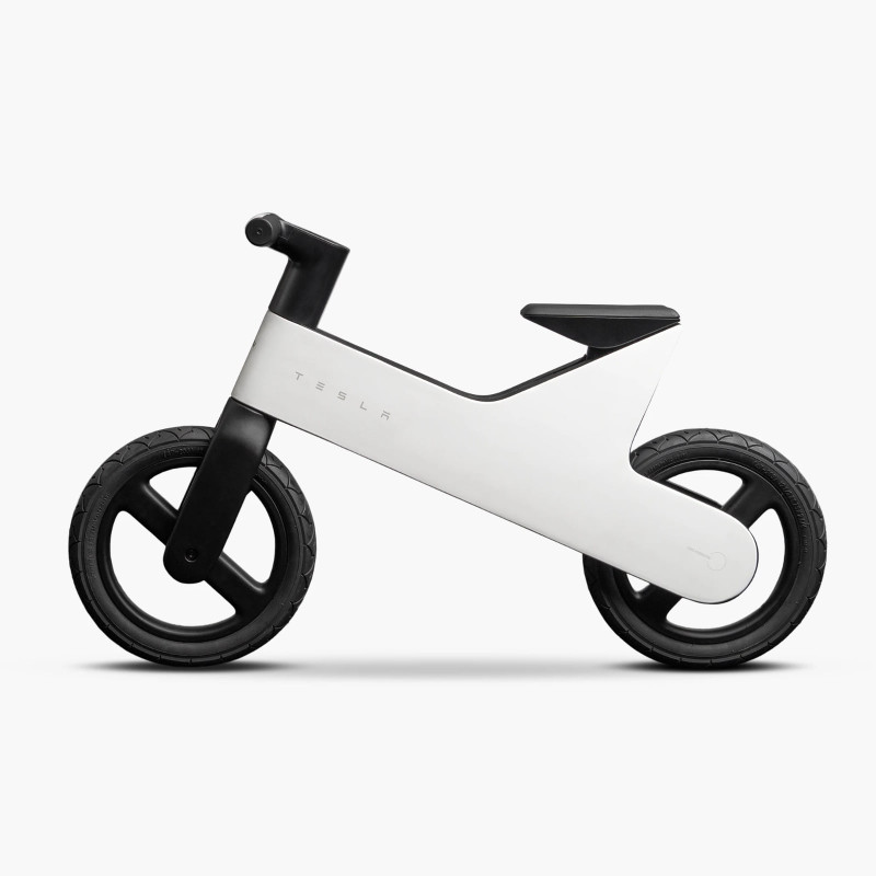
Tesla Launches Electric Cybertruck Replica for Kids in the US
Tesla introduces its scaled-down Cybertruck for children aged 6 to 12, an electric vehicle priced at USD 1,500, currently exclusive to the US market.
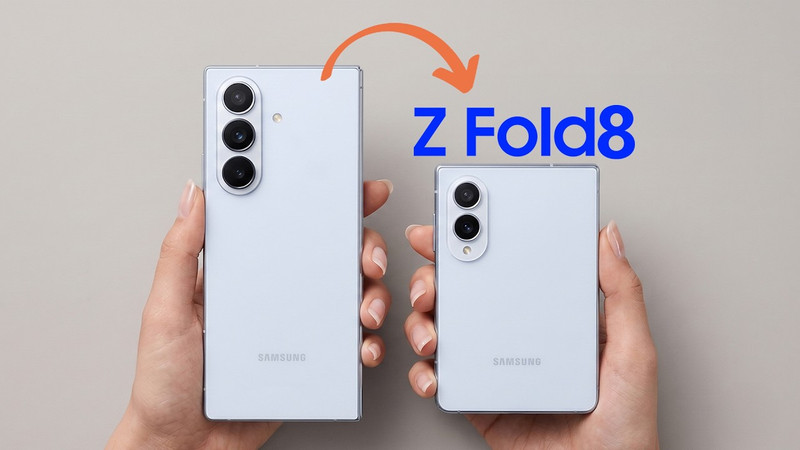
Samsung Galaxy Z Fold 8: "Passport" Design and Specs Leaked
Samsung's upcoming foldable, the Galaxy Z Fold 8, has been fully leaked, revealing a more square design and details on its displays, processor, and battery ahead of its official July launch.
Latest news
View all
Assassin's Creed Black Flag Resynced Smashes 3 Million Sales, New Game Plus Announced
Ubisoft's successful re-release of the pirate classic continues to break records, confirming one of the most requested features from the gaming community.

TikTok tests AI tool to protect creators from deepfakes
The video platform is rolling out an opt-in feature allowing users to verify their identity and report unauthorized AI-generated likenesses.

The Batman II Delayed to 2028, New Teaser Freezes Us with Excitement
Warner Bros. Pictures confirmed another delay for 'The Batman' sequel, pushing its release to early 2028, but offset the wait with an intriguing, icy first look.
Comments (0)
No comments yet. Be the first!
Only registered readers can comment.